Tag Archives: Riding Mountain National Park

In the spirit of the project.

I am trying to take the firm conceptual groundwork I developed in the project and make a single drawing that captures how that works across scales – across systems. This drawing is trying to gather in all that I have done into one piece. The technique I have been using allows me to do test renders occasionally to see where the changes I have made are heading – this is the latest test render of the collaged perspective.

test render

Tagged , , , , , , , , , , , , , , , , , , ,

just one more

I had ended up with an odd number of sheets to go on the wall – that won’t do! Here’s the final render for the set of images. I think it rounds out the experiences from indivudual, personal spaces to group led formal spaces to this public gathering space.  When I was home this summer doing research this summer I was able to see the Winnipeg Symphony Orchestra perform in the shaded area just a couple hundred meters from my proposed siting of the RCOC building. The concert was almost rained out – a real problem when you think about the value and delicacy of the instruments they were all playing. A venue space, informal yet able to provide this vital space has always been in the back of my head – from the triathlon to the fringe fest or WSO concerts there is a need for this kind of semi-enclosed performance space.

Concert


This is one of those funny projects where it’s ok to pin up an orchestra performing next to an animal necropsy being performed.

Tagged , , , , , , , , , , , , , , , , , , , , , , , , , , , ,

Yet another iteration…

Aerial


Trying to work out the best way to show a view of the whole project. I think this is working better than the Axo I posted earlier. The Resource Conservation Operations Centre occupies the northern end of the large parking lot, the dry pond is below the building and parking surface and both pedestrian greenways are visible intersecting at the entry plaza to the east of the RCOC. The recycling drop off centre is sheltered by a light canopy – the edge of the canopy frame would support a cable fence to black-bear proof the facility.

Tagged , , , , , , , , , , , , , , , , , , , , , ,

Rendering

As I work through my list of necessary drawings in preparation for my thesis defence next week I have begun to think about how I want to render the project. The base images from Revit with their photo-real attempts are unsatisfying, but with some photoshop collaging they can be inhabited. I am working towards using these images as a base for a collage which is then painted in as a digital watercolour. The below images show a before and after working out the process and how I want to approach the final images. Yes I know there’s a wall in my stairwell… this is just a test.

skyroom small

Rendering output from Revit rendering engine.

Sky Room Watercolour

After processing in photoshop.

Tagged , , , , , , , , , , , , , , ,

Content to graphics…

The images I posted earlier today represen the kind of raw output images that Revit gives me access to once I’ve built the model with sufficient detail. One drawing I have on my list is a conceptual drawing that speaks to the landscape reference and integration in the geometry of the roof and the design approach in general. Similarly the cyclical water levels of clear lake represented in the graph from Parsons and McGuinn in Prairie Perspectives Vol 2 is an idea that is present in the use of a sine curve to drive the geometry of the roof structure. The three canopy roof structures expand on the idea of surface – impermeable surfaces being the primary source of accelerated stormwater runoff due to human inhabitation. The other diagrams speak to a strategy to use the proposed RCOC and stormwater retention pond as a ground-coupled heating strategy for the new building and to offload expensive environmental control costs from nearby heritage buildings. The green diagram shows how the stormwater system and RCOC work together with the existing Visitor Centre and Ominik Marshwalk to extend the Park’s most popular trail and to highlight the town’s sustainably stormwater management infrastructure and the research being done at the RCOC.Sine Curves - Base Image

Tagged , , , , , , , , , , , , , , , , , , , , , , , , , , ,

documenting

As I work up my final draft of my thesis document I am taking the time to photograph some of the models that have been critical in my process. After going through and editing them for the document I thought it would be a good idea to put the set up on here. Enjoy.

1:10,000 scale hydrologic cycle model

1:10,000 scale hydrologic cycle model

1:5,000 scale existing stormwater system in Wasagaming

1:5,000 scale existing stormwater system in Wasagaming

1:2,000 sustainable stormwater system scope

1:2,000 sustainable stormwater system scope

1:2,000 detail view of proposed Resource Conservation Centre

1:2,000 detail view of proposed Resource Conservation Centre

1-50

1:50 systems/structural concept model

interior 2

Interior of 1:50 model showing sine curvature of roof

interior 1

Interior of 1:50 model


Tagged , , , , , , , , , , , , , , , , , , , , , , , , , , , , , , , ,

Sythesizing

One of my struggles over the past 8 with this projects has been to take my interests in architecture and my perception of the problem specific to Clear Lake and synthesize my research and design work into a coherent project. I have talked a lot in the past 6 months about the system scale analysis and proposals that are key to the macro view of this project. Now I am sprinting to the finish to try and get this whole enormous proposal resolved at the scale of the building. As I have previously stated, I am proposing to move the research labs from the maintenance compound outside of town to a large underused parking lot that is a major feature of my storm water system proposal. An early iteration of my work was investigating a parametric (Grasshopper plugin for Rhino3D) generative model for a roof that could be configured to make elegant sine curves using straight lines and repetitive units. There was something beautiful in that early work that I wanted to bring back into this Resource Conservation Operations Centre so my last week or two has been focused on rebuilding that entire script to produce a roof and structural system. The following screen captures show the evolution of that work. Enjoy!

Bill-ding.

Bill-ding.

bldg!

A building takes shape

system begins to emerge

system begins to emerge

Flight of the valkyries

Finally working with just one surface.

Finally working with just one surface.

Floor plans or something?

Floor plans or something?

First attempt :/

First attempt :/

Tagged , , , , , , , , , , , , , , , , , , , , , , , , ,

A building

I’ve been pretty involved the past few weeks with the PPARFM conference I spoke about here and moving my project forward towards the looming penultimate deadlines with coming March. A huge step forward has been a slow and inexorable increasing in scales. The first of my systems models was at 1:10,000 scale and the second model  was at 1:5,000. The most recent of these large scale system models is below – a 1:2,000 monster showing the entire scope of the proposed/affected hydrologic system.

080f09ce6a5411e2af3622000a9f17ea_7

The most recent addition to this set is a work in progress at 1:400 – building scale! Conversations with RMNP led to my discovery of a need to upgrade existing deficiencies in the building housing a number of research and management programs in the compound located about 3 kilometers from the town of Wasagaming. This led me to the idea that in light of the current political situation at parks, in light of the funding cuts that have been occurring for decades, it was a perfect opportunity to suggest a new strategy for Riding Mountain. By leveraging the research done at parks as part of the experience of parks and by building a space that enables education and outreach to become potential revenue streams, the research is protected as a vital and integral – non-negotiable – component of our parks system.

9bd0c6626fe411e2bbaa22000a1fb198_7

This model locates the proposed facility at the north end of the large gravel parking lot between the commercial district on Wasagaming Drive and the cabin neighbourhood of the Old Campground.


Tagged , , , , , , , , , , , , , , , , , , , , , , , , , , , , , ,

Building as System

I started trying to understand the broader systems context of my thesis topic by make a model that showed up a while ago in this post.  This was a critical transition to working in a more inductive way – trying to find a solution in my understanding of the problem.  It was at that point that the scope of the project changed from a building that accepted the infrastructure as built and proposed to one that sought to rethink the issue of stormwater as a whole and to find opportunities for architecture within this critical analysis.

In an attempt to move the project forward I have built a second systems model at twice the scale (1-5000) of the last one that explodes the stormwater layer from the last model into its constituent parts and includes the vegetation/permeable layer and evapotranspiration connectivity of flow.

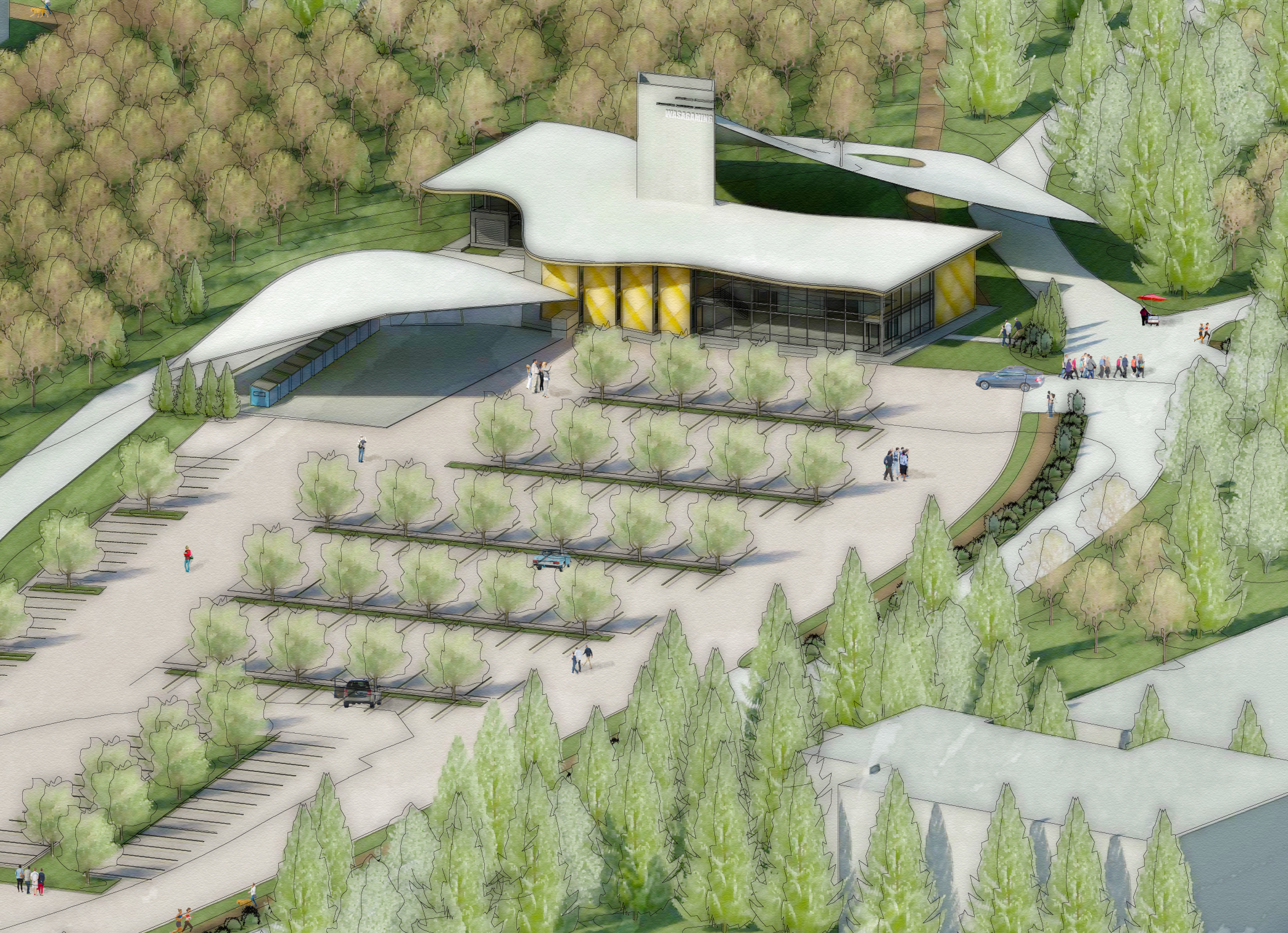
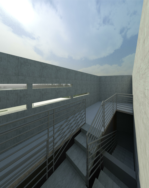
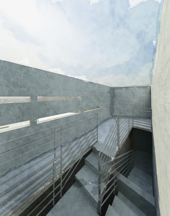
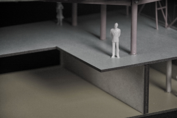
The third model I plan on making is only in digital form but I will laser cut and assemble it tonight.  This one makes a huge leap from 1-5000 to 1-50 scale.  The language is the same, but this model shows the architectural or building scale proposals I am working on and bring the ideas of structure, programme, identity, permeability, infrastructure, systems analysis and diagramming together to represent abstractedly one of the groundwater recharge zones I am proposing with a water tower and a permeable paving system.  Pics of the finished model to come!

Tagged , , , , , , , , , , , , , , , , , , , , , , , , , , , , ,

Sources

Why is storm water an issue?  There’s not much in the way of infrastructure in nature for managing it.  Surface runoff form streams and rivers and lakes – that part is visible and makes sense. Where does the rest of the water go?  It is held by permeable soils, taken in through plant roots and filtered down until it recharges the aquifer.  Urban systems have issues with storm water because we have taken a huge amount of permeable surface area and made it impermeable.  This concentration of the flows creates large volumes of water with major impacts on our daily lives and so we as societies build massive pipes underground to collect and direct this water.  In Wasagaming this water has been dumped – laden with pollutants – into the main beach area and a number of other outflow points.  The proposed solution diverts this flow into Ominik Marsh.  Ominik is the last stage in the filtration and cleansing of the waste water and sewage from Wasagaming.  What happens when you increase the flow rates of the marsh system by dumping millions of litres of storm water into it every season?

To understand the sources of storm water and conceptualize how big an issue this is I have mapped out the impermeable surfaces in Wasagaming – parking lots, roads, paths and roofs.  The large squares in the image show the accumulated total area of each system.  Interestingly it came out that parking is a 200m x 200m square, roof areas are a 300m x 300m square while roads are by far the largest at a full half kilometer squared – 500m x 500m.  More analysis to come as I use these areas to calculate runoff volume and begin to test ideas about permeable surfaces to reduce storm water volume drastically. Total impermeable surface area?  94 acres – that’s almost 400,000m2.

Tagged , , , , , , , , , , , , , , , , , , , , , , , , , , , , , , , , , ,